Active weather to pause for the weekend
Thursday, February 12, 2026
Thursday mid-afternoon temperatures are around 40 degrees in Steamboat Springs and 25 degrees near the top of the Steamboat Ski Area, with cloudy skies and high-elevation snow showers. The bulk of the storm that brought 10” of snow to mid-mountain and 14” up top so far will depart the area in time for a pleasant Washington’s Birthday weekend, with a beautiful mostly sunny Saturday followed by a much warmer but mostly cloudy Sunday and Monday. Active weather returns for Tuesday and again for the end of the workweek.
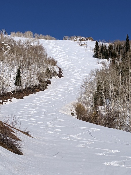
After 4” of snow in the last 24 hours was observed at mid-mountain and 6” up top, along with a third of an inch of precipitation in town which was mostly rain, a morning of snowfall brought an additional 6” of snow to mid-mountain and 7” up top, highlighted by a couple of heavy snow showers sporting 3” per hour snowfall rates that dropped 2” of snow between 9:40 am and 10 am, and 1” between 11 am and 11:20 am. However, the mid-mountain accumulations have already settled an inch and a half in the two and a half hours since noon, amid warm, springlike temperatures.
The storm responsible for the sorely needed snowfall is still to our west, stretching from Nevada southwestward to off the Baja coast. The storm will consolidate and move eastward, crossing the Southern Rockies early on Saturday. Most of the energy will remain to our south, but lingering moisture and energy will keep showers going over our area for the rest of today and Friday. Some of these showers may be heavy, especially later this afternoon and evening, with each shower possibly leaving another quick inch or two.
Dry air behind the storm will lead to a beautiful, mostly sunny Saturday as a ridge of high pressure behind the storm and ahead of the next storm moves overhead. This next storm will develop in the Gulf of Alaska on Friday and split early on Saturday, with most of the storm elongating southward along the West Coast and forming an eddy by Saturday night. High temperatures in town will warm from around 40 degrees on Friday and Saturday to the upper forties on Sunday, with another fifty-degree day possible on Monday, despite some cloudiness ahead of the next storm.
Additionally, a storm near Japan will ride over the top of a ridge of high pressure developing south of the Aleutians, mixing with cold air around the Bering Straight on Sunday, and interacting with the eddy off the West Coast on Monday. Current weather forecast models show storm chances on Tuesday, followed by a colder, possibly stronger storm for the end of the workweek.
So enjoy the snow leading into a gorgeous start to the long weekend, and I’ll have more details and snowfall guesses for the workweek storms in my next regularly scheduled weather narrative on Sunday afternoon.


