Departing storm leads to a beautiful weekend before another significant storm approaches Sunday night
Friday, November 1, 2013
After another 3” fell overnight here on my front deck near the base of the Steamboat Ski Area, drier condition should overspread the area by tonight, although showers will persist at least this morning in favorable, but drying northwest flow.
A beautiful weekend with seasonal temperatures looks to be sandwiched between the currently departing storm and next very significant one forecast to impact the entire Rocky Mountain region for the next work week.
This next complex storm will consist of three waves of energy, with the last bringing unseasonably cold air. The first weak wave will pass over southern California early in the weekend and be over our state by Sunday. Light precipitation may occur over the southern-most areas, but the north will remain dry until the second wave preceding the main event approaches Sunday night.
As this weak wave passes over the area, light precipitation will continue in cool but seasonable temperatures during the day Monday. Meanwhile, the bulk of the storm will continue to develop to our west as the unseasonably cold air associated with the third wave strengthens the storm.
A split develops in the storm as the storm is stretched between the departing second wave and approaching third wave. The third wave looks strong enough to form a closed low that moves over the state on Tuesday. Very strong forcing looks to create precipitation bands which are difficult to localize but will produce moderate to heavy snowfall rates.
The last wave should be east of the Divide by late Tuesday and will finally drag the coldest air of the season over the state, producing significant and likely impressive snow amounts. Wednesday will be cold with our area susceptible to showers in the cold, but rapidly drying northwest flow.
A building ridge should produce warmer than average temperatures by the end of the work week and most of Saturday before yet another storm affects us by Sunday.
More fall colors from from the Steamboat Ski Area
Monday, September 30, 2013
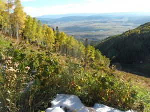 It’s remarkable what a day of sun will do to dry out the mountain, as I was able to ride to 9000 feet and snap some more pictures of our rapidly evolving fall landscape. The picture on the left was taken from Duster looking down towards Moonlight and highlights the South Valley of Routt County. The picture on the right is a similar perspective, but vertically oriented.
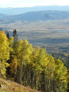
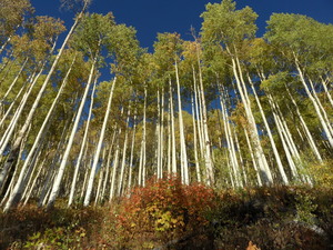 Moving further up Duster towards Rendezvous Lodge, the picture on the left was taken from Duster looking up into the Twilight trees. Lastly, the picture on the right was taken near Rendezvous saddle looking up towards High Noon.
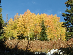
Chilly mountain bike ride, but beautiful fall color
Sunday, September 29, 2013
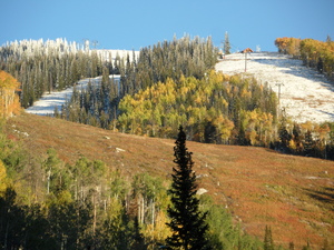
After our first significant wintry mix down in the valley on Friday, some portions of the trail had dried enough by the end of the day to venture out. I was able to get to just below 9000′ on the BC Skiway portion of Tenderfoot before turning around in chilly 39F temperatures, but was able to capture Storm Peak with snow in the pines and color on the aspen near sunset. I’m guessing around 6” up top based upon a similar amount recorded at the Tower Snotel site located on Buffalo Pass at a similar elevation to Mt. Werner
Fall colors above 9500 feet
Monday, September 23, 2013
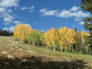
After an interminable monsoon and a very wet September, fall colors are appearing above above about 9500 feet, at least as of the fall equinox. A storm blew threw last night and we also have our first snow about half way up Mt. Werner. The colors started later than usual due to the warm and wet conditions in the first part of the month, but it appears the color will be good this year, although not long-lasting due to the late start.
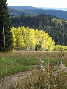
The picture on the left was taken on the Sunshine Trail in the Priest Creek area looking down toward Rendezvous Lodge. The picture on the right is taken on Pet’s Wicked Trail just above the intersection with Cathy’s Cutoff.
SnowAlarm redesigned to be responsive and mobile-friendly
Sunday, August 25, 2013
Welcome to the 2013-2014 season. Loyal visitors to this site will notice a big difference in the layout as this site is now responsive, meaning that the layout will change depending upon screen size and the content is arranged in columns that will vertically stack as the screen size decreases.
Currenlty, the regisration and login process are not functional as I implement a new registration process.
The slideshow of the homepage is very interesting as it is the the same camera perspective taken in different seasons.
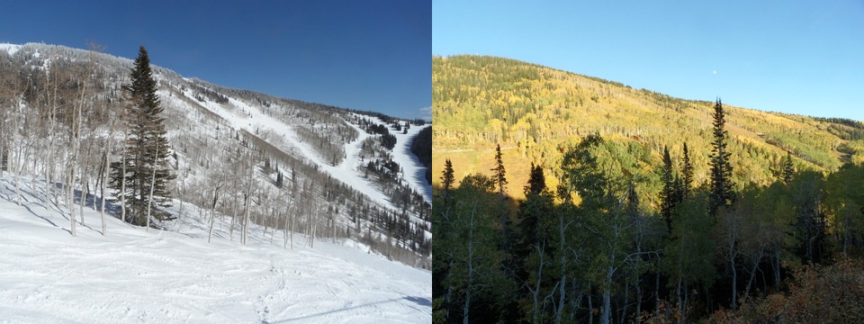
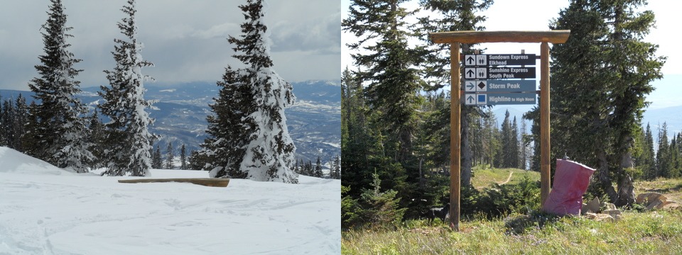 Immediately noticeable is the almost completely buried trail sign at the top of Storm Peak. The ‘winter’ shot was taken on 1 May 2011 while the summer shot was taken a few months later on 4 Septermber 2011. We received a record 489” of snow, although if the area had stayed open anoher week, we wouild have been close to 550”. Incrediably there was more snow at this time than when the season closed in mid-April.
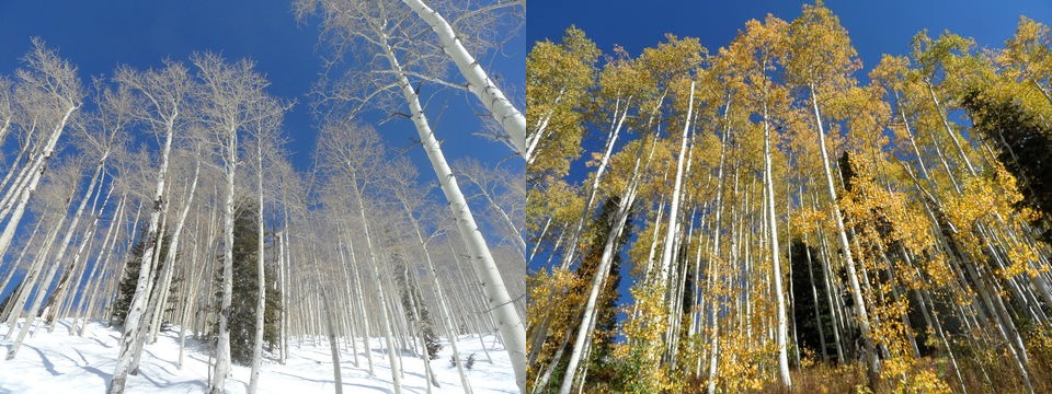
 Note the height of the aspen trees iin the Shadows area as the winter trees have their bases covered with almost 15 feet of snow. The winter shot was takem on 23 March 2011 while the fall shot was taken almost a year earlier on 25 Sept. 2010.
Lastly, the thrid photo montage is of the Priest Creek area taken from near the Elkhead lift. As with the aspens above, the winter shot was taken on 23 March 2011 while the fall shot was taken almost a year earlier on 19 September 2010.


